
Another long and unpronounceable name, it must be another trip to Chiba! This time, prepared like a pro, and much more at ease with navigating in japanese and with *shudders* japanese maps, it was with high expectations that I set out for Chiba once again.

For a long-standing, maritime culture like Japan, they make the most horrendous maps I've ever seen. I refused to believe, though, that they lack logic all together, and so after many months of study, have finally found a key to japanese mapping!
For large-scale maps, I guess they feel internationally pressured to use such denominators as North and South, and distance scales. For smaller, local maps, however, we enter into the reign of the japanese mapping fantasy. The maps must include the train line, the station, and all intersections with traffic lights. All other streets, too modest to have their own traffic lights, will be added at the artists inclination.
 'Up' is almost directly South, here
But what really sends you off (literally) into the woods, is the orientation of said half-filled out maps. The train line will go horizontally across the map, regardless of where North is. The top of the map is, in fact, the direction you are facing while you are looking at the map! This seems dull, but it has the huge implication that the exact same map on the opposite side of the street will have the 'top' on the bottom of the map, all the writing now facing the new 'top'.
With all this in mind, I only got lost about 50% of the time, instead of all the time!

I left Oppama early, to get on a bus in Yokohama, which whisks you up the coast to where Haneda airport is, then down into a tunnel,
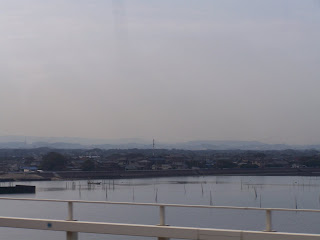
and in just 30 minutes, up you pop on the shores of Chiba peninsula! I took the bus to Goi station, where the Kominatotetsudoline train was waiting for me! This is another of those "seen on television" must, and so I gladly joined the motley crew of day trippers, cameras out and on the ready.

The line starts out though the rather small city of Goi, and then out into large flat rice paddy land, with just the hint of hills in the distance. The stations are of the old spaghetti western kind, clapboard wood painted while, with flowers along the quay, and a lazy cat on the bench outside the station.


Not far from the first station was a very nice temple, in its little cedar grove, with beautifully carved dragons and cranes above the main entrance.


Then quickly back to the station, and on the the next stop on the line. You'll have to excuse the lack of names here, but although I have the names written in kanji on my map, I haven't a clue how to pronounce any of them....

This station was actually close to a small town, but rather than go there, I took a small local road straight across the rice paddies, heading for the hills. The rice has been cut, but it looks like they might be trying for a second cutting this year, as the stumps have been left to grow.

The small clusters of houses out of town, on the edge of the hills were what were truly worth the walk. They are the houses of the farmers tending the rice fields and vegetable crops, and all have that old, lived-in beauty that you only get in farm houses.


Beyond the rice fields, the road wound around through a small wood, to a very small shrine in a bamboo and cedar grove. It looking so abandoned, I decided to put a coin in the little box, and ring the bell, wishing for general good luck.


Just minutes after, I saw this very big and beautiful snake. That is, admitedly, not everyone's definition of luck, but why not?

Many more animals were also out and about, with the largest butterfly I've seen a long time.

As well as hordes of dragonflies, crayfish in all the ponds and streams, as well as a frog or two, and even some kind of grasshopper thing.


No comments:
Post a Comment